Georgetown Lake
1 mi west · US Army Corps of Engineers
Located 4 mi W of Georgetown via FM 2338, the lake is easily accessible from the Austin area. The dam impounds the San Gabriel River in the Hill Country of central Texas.
Outdoors
Day-use and picnic areas near Georgetown on public land, from quick drives to full-day outings.
Good to know: Group picnic sites can often be reserved; fire rules change with the season, so check before bringing a grill.
1 mi west · US Army Corps of Engineers
Located 4 mi W of Georgetown via FM 2338, the lake is easily accessible from the Austin area. The dam impounds the San Gabriel River in the Hill Country of central Texas.
2 mi west · US Army Corps of Engineers
Cedar Breaks Park sits on the south side of Georgetown Lake in the Hill Country of Texas, about 25 miles north of Austin. Recreation Boating is the most popular way to enjoy the lake, and a boat ramp is provided for guests.
4 mi west · US Army Corps of Engineers
Russell Park is located on the west side of Georgetown Lake, in the Texas Hill Country approximately 25 miles north of Austin. Visitors enjoy boating, fishing and exploring the San Gabriel River Trail.
Map of 17 places loads as you scroll.
Located 4 mi W of Georgetown via FM 2338, the lake is easily accessible from the Austin area. The dam impounds the San Gabriel River in the Hill Country of central Texas.
Cedar Breaks Park sits on the south side of Georgetown Lake in the Hill Country of Texas, about 25 miles north of Austin. Recreation Boating is the most popular way to enjoy the lake, and a boat ramp is provided for guests.
Russell Park is located on the west side of Georgetown Lake, in the Texas Hill Country approximately 25 miles north of Austin. Visitors enjoy boating, fishing and exploring the San Gabriel River Trail.
Open to the public March 1981, know as one of the top five crappie/white bass fishing spots in Central Texas.
Historical sites include the Stage Coach Inn in nearby Salado. Stillhouse Hollow Lake is located near the Fort Hood Army Base, which has several points of interest for the military buff.
Historical sites include the old "Charter Oak" on the Leon River, near the City of Belton, and the Stage Coach Inn in nearby Salado. Tour Miller Springs Nature Area located below Belton Dam.
Belton Lakeview Park has two reservable group day-use areas along the lower shore of Belton Lake, providing some of the best fishing and boating in Central Texas.
Cedar Ridge Park campground is located on the Northern side of Belton Lake. This year-round campground accommodates both tents and RVs and has several sites with screened shelters for those who do not have camping equipment.
In the early part of the 19th century, the lower Guadalupe River Basin, below the current location of Canyon Lake, had been especially subject to serious flooding. Congress authorized in the 1940's the construction of Canyon Lake Dam.
The largest lake in the United States to be located entirely within a single city's municiple boundaries.
Nearby points of interest include Bluebonnet Trails, Independence Day Trek and Salt Grass Trek.
There are 10 Corps of Engineers parks, one state park, and three additional parks managed by Hill County or private individuals. Equestrian riders have a great place to explore rolling hills and woods in the McCown Valley Equestrian Area.
This 3,280-acre lake is located on Aquilla and Hackberry Creeks.
Located in historic territory of the Comanche Indians, Proctor Lake offers a wide variety of activities both on and off the water.
Navarro Mills Lake holds the state record white crappie at 4lbs 9 ounces.
Attwater Prairie Chicken National Wildlife Refuge was established in 1972 to provide habitat for one of the last populations of the critically endangered Attwater’s Prairie-Chicken , a ground-dwelling grouse of the coastal prairie…
Bardwell Lake is located in the Blackland Prairie region of southwestern Ellis County. Built in 1965 for flood control by the US Army Corps of Engineers, Bardwell Lake is located two miles southwest of Ennis off of State Highway 34.
Distances are straight-line miles from downtown Georgetown. Listings come from Recreation.gov’s federal recreation database; check each official page for hours, fees, fire restrictions and closures before you go.
THINGS TO DO · YOUTUBE SHORT
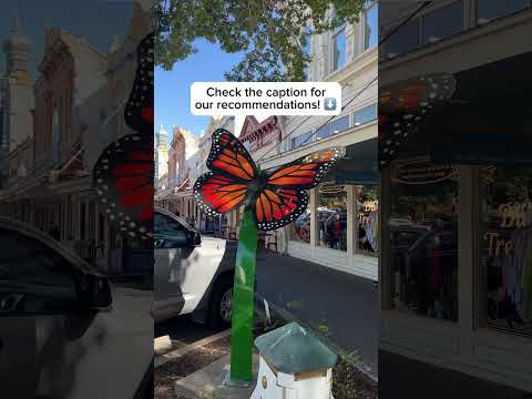
The state tourism office suggests a day of coffee, downtown murals, shops around the square, Blue Hole Park and a local winery. A Short shared by Travel Texas.
Watch on YouTube ↗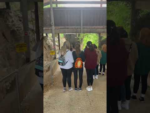
THINGS TO DO · YOUTUBE SHORT
A short walk through the lit passages of Inner Space Cavern, the show cave beside I-35 in Georgetown. A Short shared by Hubert Campbell Travels.
Watch on YouTube ↗Georgetown Lake (US Army Corps of Engineers), about 1 miles west of Georgetown as the crow flies. Next are Cedar Breaks Park (2 mi) and Russell Park (4 mi).
Based on Georgetown’s average highs, October–May. Conditions at higher elevations can be much cooler.
Federal agencies including US Army Corps of Engineers, Fish and Wildlife Service. Each listing links to its official page for hours, fees, closures and current conditions.